

 This trail will begin to go downhill, and you’ll go down stairs, across a small stream, and probably more stairs. Follow it for no more than 10 minutes.Went out to the temple, Seokbulsa (석불사). Admittedly, this is not easy to find or to hike to. I got my directions from Meet You In Korea -but still had to ask at least half a dozen random hikers for clarification.
This is the information from about the temple from their site:
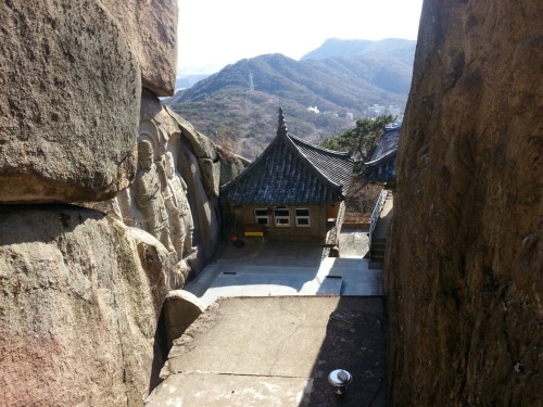
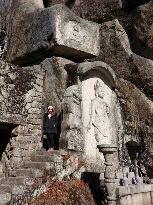
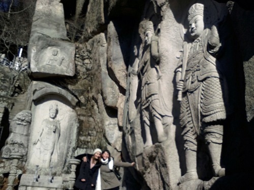
The history of Seokbulsa Temple is nearly impossible to find online and in English, but here is what I have pieced together. The temple was founded in 1930, during the Japanese occupation of Korea. This is unlike many of the other temples and sites on the mountain, which are all much older. A monk by the name of 曺-鉉 selected this location on the mountain due to the distinct rock formations which are made of sandstone. It was him who meticulously carved the stone for many years, and incorporated both modern and ancient aspects of Buddhist art into his work. The stone carvings are in great condition and are very detailed. Inside the temple grounds are some much older artifacts, but it is unknown where they come from or what the story behind them is.
If you’re up for a steep hike and beautiful scenery, go check it out. I am not super fit so it took me two hours to hike to the temple from where the cable car dropped us off.
How to find the temple:
- Take the #1 subway to Oncheonjang Station and proceed out Exit 1. You can walk to Geumgang Park (금강공원) from there in less than 10 minutes.
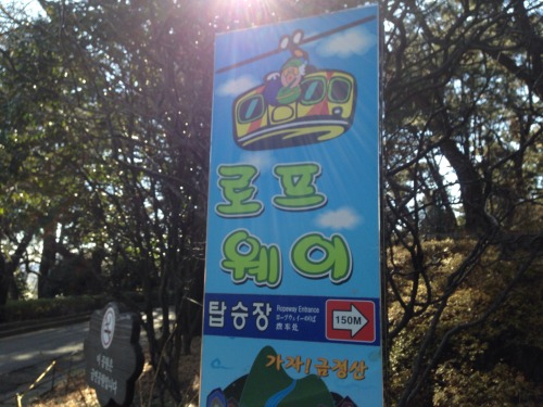
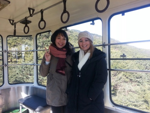
- Once inside the park follow the signs to the ropeway where you can buy a one-way ticket for 4000KRW.
- At the top of the mountain follow the signs for the South Gate. Walk along these paths until you come to an intersection in the path with 4 choices – and nearly all of which are in Korean. We followed the path that was on the left of where we came from and sloped downward.
- This will lead you to Nammam Village, where there are many restaurants and fenced sports courts. Go straight through the village and then turn left, crossing a small stream.
- This trail will begin to go downhill, and you’ll go down stairs. You will come to a big fork in the road with a sign post for the temple (finally!) where the current trail veers left and a new, and steep, trail goes straight and down a lot of steps and more water.
- Pass the outdoor exercise facility and go up the steep trail until the very end. Turn right up the road and don’t stop until you reach the top.
- After the temple, the easiest way home is by following the road all the way to the bottom. It’ll bring you close to the Mandeok subway station on line #3.
Recent comments